Tesuque
Conserved Land: 22 Easements, 398.5 Acres
Description & History
The name ”Tesuque” is a Spanish adaptation of the Tewa place name ‘Tat’ unge’ onwi” which means, “cottonwood place.” The Tesuque Creek watershed and bottom lands in the vicinity of modern-day Tesuque village are within the ancestral and traditional landscape of Tewa-speaking people of the Pueblo of Tesuque. Archaic hunter-gatherers camped along the floodplain for 4,000 years before the first Ancestral Puebloan farming communities were established between AD 900 and 950. The Pueblo of Tesuque was inhabited when the Spanish settled in Northern New Mexico at the end of the sixteenth century. The people of the Pueblo of Tesuque were involved in planning and initiating the rebellion against the Spanish colonists in August 1680. The rebellion expelled Spanish colonists, administration, and mission priests for thirteen years.
The first of Hispanic settlement in the Rio Tesuque area occurred in 1732 after the De Vargas Reconquest of 1693 when Antonia Montoya sold Juan de Benavides a piece of land containing much of what is now Tesuque. EI Rancho Benavides extended from the current southern boundary of Tesuque Pueblo to the junction of the Big and Little Tesuque rivers between the mountain ridges on the east and west of the river. EI Rancho Benavides became known as San Ysidro, who is the patron saint of farmers. The name is still used for the local church today. In 1752, Juan de Gabaldón obtained much of the Rio Tesuque region in a land grant from the Spanish Territorial Governor. In 1776, Fray Francisco Dominguez visited Rio de Tesuque village and documented that it contained 17 families with 94 people.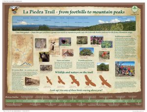
The acequia system established with the settlement of El Rancho Benavides provided a means of fairly distributing crop irrigation water and it was a cultural link for the whole community. Acequias supplied the community’s drinking water, formed a network of paths connecting individual residences, and through the “mayordomos” control of water rights provided an effective political system that structured the entire village society. Land transaction and acequia records through the Spanish and Mexican periods show continuous use of the valley and its water for agricultural purposes. A number of those same acequias irrigate the valley today, with over 150 registered water users belonging to the five acequia associations of the valley. The patterns and configurations of land division and land use in Tesuque today reflect this historic acequia network and the associated agricultural uses of the past.
The watershed of the Rio Tesuque sustained Pueblo of Tesuque villagers and Spanish settlers providing a route into the nearby Sangre de Cristo Mountains for seasonal livestock herding, hunting and the gathering of firewood, piñones and other food resources and raw materials. Portions of the historic trail system that remain today are used for recreation. In 2012, the Santa Fe Conservation Trust help create the La Piedra Trail connection connecting the Santa Fe County La Piedra Open Space to the Santa Fe County Little Tesuque Creek Open Space both of which are also protected with conservation easements held by SFCT.
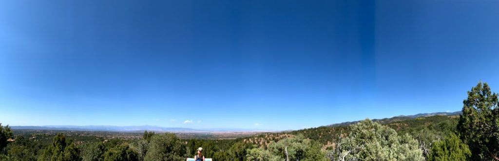
With numerous houses and buildings used for business and residential purposes since the mid-1800s, Tesuque retained a rural and subsistence lifestyle into the 1970s. Over the last 40 years a wave of newcomers seeking a rural lifestyle close to the City of Santa Fe have developed hill tops and new home sites on the valley floor. Undeveloped parcels are important links to Tesuque’s rural heritage and landscape. Preservation of properties in perpetuity will protect the scenic views of Tesuque that are enjoyed by residents and the general public. Development throughout the Tesuque area is occurring rapidly; protecting it from further subdivision and development will help ensure that this natural area remains intact and available as wildlife and plant habitat in an area that is becoming increasingly fragmented.